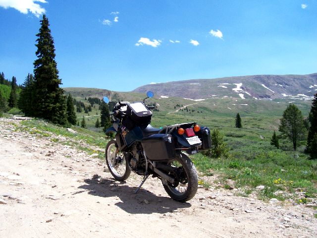
Nancy and I elected to trailer to STAR this year rather than ride across the plains since we were much more interested in riding in the Rockies than grinding across Missouri, Kansas and eastern Colorado in the heat and seemingly ever present headwind. I took my KLR650 to STAR '06 instead of my regular street ride (ST1100) for several reasons. The ST1100 is a challenging bike to trailer and I had in the back of my mind that I wanted to do a little Dual Sport exploring while there so I cast vanity to the wind and settled for the big ole ugly KLR even though we had a lot of road miles planned. After mounting some street tires (Avon Gripsters), a 16-tooth countershaft sprocket and a set of ancient fiberglass bags (originally from an Yamaha RD350) we loaded up the KLR and Nancy's SV650 and headed for Avon.
We actually arrived in Avon 6 days early on June 12, unloaded the bikes at the Christie Lodge and then set out a 5-day excursion down to the North Rim of the Grand Canyon with friends Cliff and Mary Cook. What can I say - it was GRAND! We have lots of pictures of that trip but that, as they say, is another story. This page is about my dual sport adventure. Anyhow, upon returning to Avon for STAR on 17th, Nancy decided that she's had plenty of saddle time already and took a couple of short days to rest up so I used this time to explore a bit on my own.
The Colorado map shows an unpaved road between Leadville and Fairplay. However, my map didn't tell me there was a 13K foot pass (Mosquito Pass) in the middle nor did it mention that it's not usually open until July. Since it wasn't obvious in Leadville where the actual road intersected the main highway, I stopped at Bill's Outdoor Shop (hiking, biking, camping, kayaking, etc) to ask. They told me how to find the road but advised that it might not be open all the way through due to lingering snowfields. In exchange for their help, I agreed to call them and them know if it was passable. Had I known how rugged and remote the terrain would end up being, I probably wouldn't have gone on alone. However, there was one other adventurer in a Jeep up there and I always had cell phone connectivity so I didn't feel too isolated.
Climbing out of Leadville towards Mosquito Pass the day was sunny but not hot and as I gained altitude the temperature dropped and the wind picked up significantly.
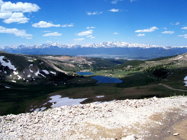
Leadville claims to be the highest incorporated city in the US at 10.2K feet and on the way up I passed their crystal clear (snow melt) reservoir at what I would estimate to be around 11.5K feet. That's Leadville at about 2 o'clock in the photo.
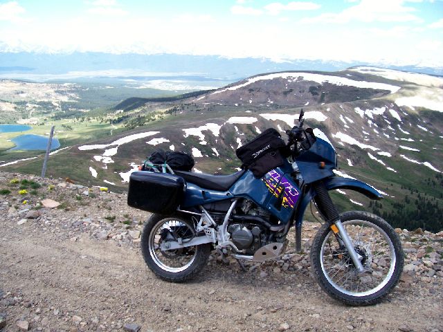
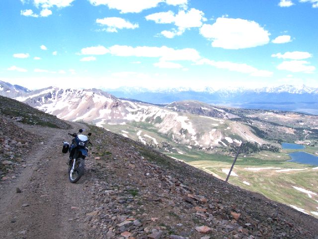
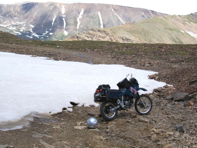
The KLR at about 12.5K feet with Leadville in the background. The road was very rocky and loose and the drop offs were significant. You didn't want to bounce off the road here. I have a huge ding in my bash plate from high-centering a big rock. Note the dirt intersection at about 10:00 o'clock - more on that later.
Looking more or less north east - it was lonely up here but my cell phone had a signal every time I checked it. Verizon is everywhere!

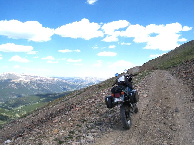
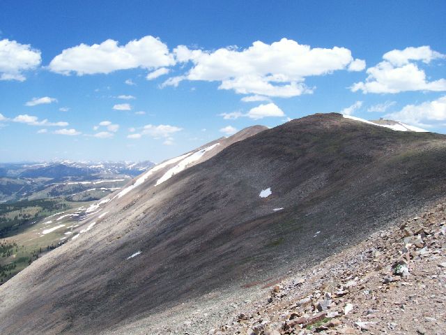
It was actually pretty chilly in the shadow of the clouds which kept passing over very rapidly. The alternate "low pass" is visible in the lower left of the picture.
Another view. I had been able to negotiate around a small snow field on a very steep section just out of sight back down the road by getting a good "run and go" at it and letting inertia carry me through. I thought this was the snowfield the folks at Bill's had been talking about but maybe not...
Approaching Mosquito Pass, there was a lateral road that runs up to what appeared to be a weather station ( the little structure in the upper right corner). For a very long time there were no other humans to be seen. However, there were lots of ground creatures scurrying about high above the tree line. These looked like ground hogs or something related and they would dart across the trail and into their burrows as I thumped by.
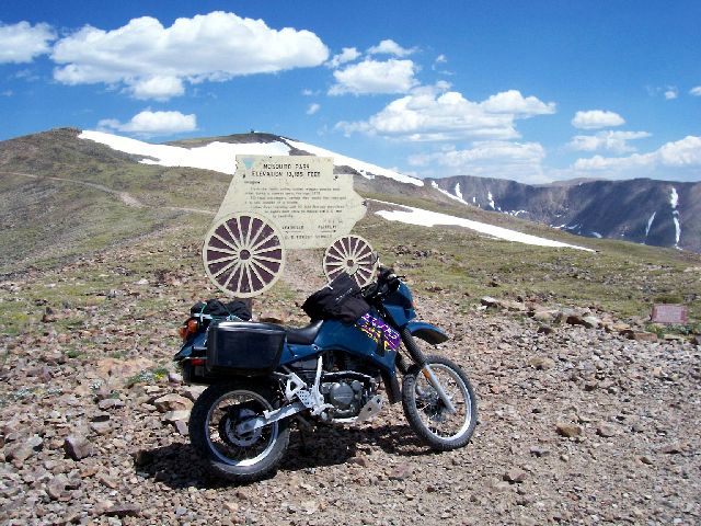
Mosquito Pass - 13,185 feet. Neither the bike nor I breathed very well up here. Notice the gray stone marker to the right of the picture. This is the gravestone of the locally famous Father Dyer who apparently delivered he mail across this pass in the late 1800's.
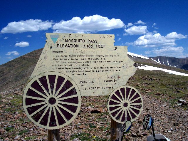
Right, just imagine...
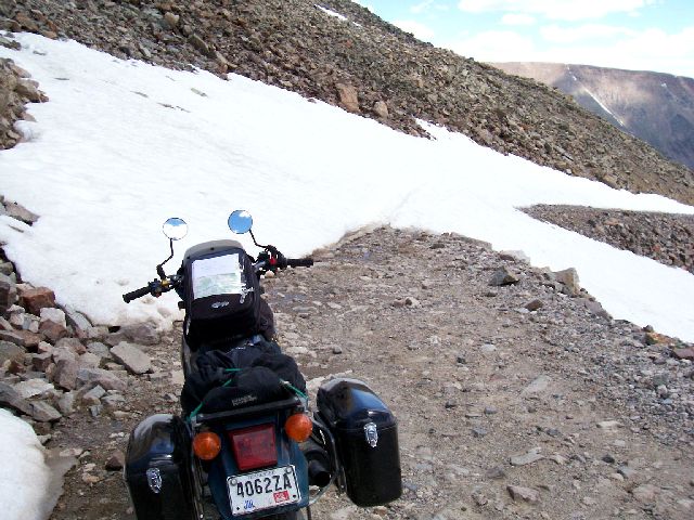
Not long after crossing the top of the pass and proceeding down towards Fairplay I encountered this snowfield. It was too large to ride across but I was able to negotiate around it on the right side.
Unfortunately, a quarter mile or so later I came upon another snowfield that completely blocked the road to a depth of 2 - 4 feet. I walked across it but it was too deep and too long to try crossing with the bike. And, it was too rocky and steep to go around above or below it. With a snow shovel and a lot more energy that I could muster at 13K feet, I could probably have cleared a path across this but that wasn't going to happen today. I had to turn back.
The "low pass" mentioned previously seem like a good alternative to get me to Fairplay so I backtracked and rode down it 2 or 3 miles. Unfortunately, the run off from the melting show had made it extremely muddy. In a lot of places it was actually more of a horse trail than a road. Although I was able to get through several mud bogs, I eventually encountered one that appeared impassable and there was no way around it with out cutting down brush or trees. Water was standing completely across the rocky road here. It was crystal clear and only about a foot deep but when I threw in a 6" diameter rock it disappeared immediately and completely in the black muck on the bottom. If I hadn't been alone, I might have tried to get through but a 350+lb KLR stuck in deep mud is more than I cared to risk at this point. Again, I turned back and this time backtracked all the way to Leadville.
It turns out my wife and some girl friends had ridden to Leadville for lunch. I spotted their bikes parked on the street and a quick call on the cell phone located them in the Espresso bar so I joined them and told my adventure story. They were not impressed - something about they didn't see why I wanted to get all muddy like that.
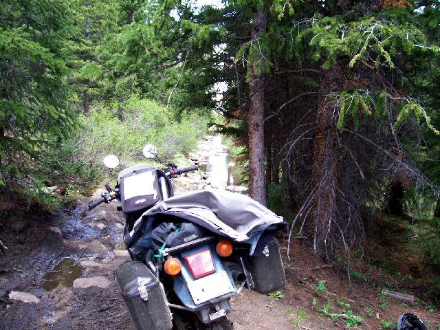
I spent the rest of my day exploring more unpaved areas but nothing like Mosquito pass. I rode on down to Buena Vista and took Cottonwood pass (paved on the eastern slope; dirt on the western side) over into a broad high plain with a big lake. There were miles and miles of wide, hard packed and very dusty dirt roads.
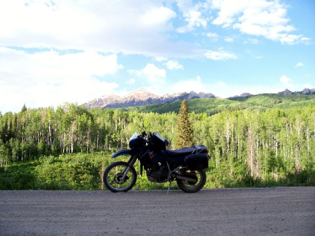
Eventually I came out on pavement again just south of Crested Butte. I briefly explored the really cool looking little town of Crested Butte (they have attempted to retain the 19th century western town aura) and then took unpaved County Road 12 over to CO133. This turned out to be one of the most beautiful rides of my entire trip as the route passes though some awesome Aspen forests and provides some really spectacular views.
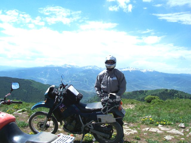
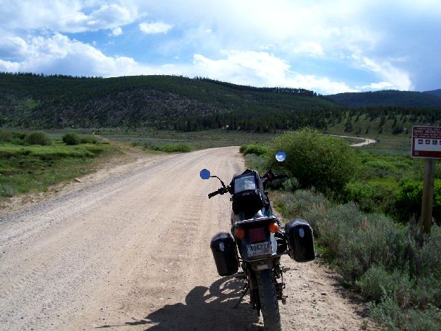
So, my attempt to cross Mosquito Pass was a failure but it was a another great adventure for my scrapbook! All in all my adventure day was about 350 miles and I dragged back into the Christie that night at about 10pm one tired but satisfied STAR attendee. It was GREAT! BTW, that's Beaver Creek ski resort at Avon in the background. The dual sporting across I-70 from Avon wasn't at all a bad ride and it was literally just across the road!