Part Two - Moab, UT
Day 1
.jpg)
Our traveling
companion to this point, Jon, had to return home so we dropped him at the Grand
Junction airport on our way to Moab. His bike (and trailer), however, made the
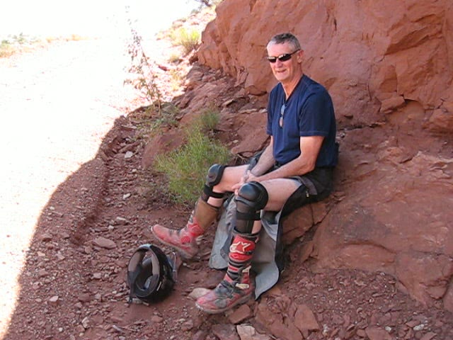
remainder of the trip with us. Here we are in the motel parking lot preparing
for our first day at Moab. It was nice and cool at this time in the early
morning. That would change later in the day.
.jpg)
The terrain here
looks NOTHING like Colorado of course. We started our day by riding to Chicken Corners
.jpg)
The water in the
distance is potash drying ponds. We'll pass by those close up when we ride the
White Rim Trail later. That's the Colorado River nearer to us.
.jpg)
Onward to Chicken
Corners!
.jpg)
Pretty typical Moab
surface. Lots of exposed rocks with a little dirt to fill in the
cracks
.jpg)
.jpg)
Not many
trees here. Not much shade either when the sun gets a little higher in the
sky
.jpg)
Out there is Chicken
Corners. Although vehicles are prohibited, the last time I was here a couple of
years ago there was evidence that someone had ridden a motorcycle
around.
.jpg)
This is the view from
the other side. Behind the camera is a flat mesa about 100 feet wide ending in
an abrupt cliff.
.jpg)
Why do they call it
Chicken Corners, you ask? Because you're a "chicken" if you don't walk round the
18" wide ledge. It's about 1,000 feet down to the river here. You would not
survive a fall.
.jpg)
Here's the view
looking back. That's Galen standing on the rocks.
.jpg)
I call these Wylie
Coyote formations. There are MANY such amazing stands of rock that simply seem
to defy gravity.
.jpg)
From Chicken Corners
we rode north of Moab across the Gemini Bridges area (didn't take any pictures
there). Our next destination for the day was the Hey Joe
Uranium Mine This photo was made at "the turn".
It's memorable because leading up to this point is a high speed gravel road.
Then you crest a little knoll and the road abruptly turns right. If you are
running a little too hot, it could be a catastrophic trip off the
ledge...
.jpg)
... into Hey Joe
Canyon. That's the road center left.
.jpg)
The ledge road itself
is in pretty good condition most places although there are a few wash outs and
rocky sections on the way down.
.jpg)
After a wet spring
and summer the Green River has flooded this area repeatedly. The riverside road
is heavily covered with sand and washouts. This is actually look back since the
road runs on the eastern side of the river.
.jpg)
And then... we
encountered the mud. Sticky goo on top of hardpack. Our bikes simply bottomed
out on the mud. We had to man-handle them out of this. There is a temperature
inversion in this canyon and Galen's little thermometer told us it was 114
degrees right here. And, although you can't see 'em, the mosquitoes were
swarming like honey bees around a comb. We might have ridden around the mud and
gone on but the conditions were just too inhospitable to proceed. We dragged the
bikes out and headed back.
.jpg)
It can't tell you how
great it felt to get into the shade near the top of the canyon. The temperature
here was about 98 but at least there was a little breeze and NO
MOSQUITOES
Day 2
.jpg)
Our mission for today
was to ride the White Rim
Trail out to the where it had been closed due to
flooding of the Green River.
.jpg)
Much of the White Rim
Trail truly is a "rim"
.jpg)
.jpg)
.jpg)
.jpg)
Amazing views
But damn was it HOT! I searched for a shady spot
to cool off for at least 30 minutes before finding this overhang.
.jpg)
In fact, it so hot we
decided to abort for the day and head back to the air conditioning and swimming
pool at the motel
.jpg)
.jpg)
Awesome road out of
the canyon
.jpg)
Galen and Lil
Pig
Day 3
.jpg)
To this point we were
riding mostly west of Moab. To the east is a mountain range and a great ride
called Onion Creek The spire is called Totem Pole -
another defiance of gravity. You cross Onion Creek something like 24 times. In
dry weather it's not very deep but there was evidence of water being 10-12 feet
up on the canyon walls from previous flash floods. The terrain on this side of
Moab is COMPLETELY different from the more desert-like western side.
.jpg)
With a sandy clay
surface that would probably be very slippery when wet
.jpg)
There are even trees!
As we gained altitude in the La Sal mountains, we actually got into some pretty
dense forest
.jpg)
Expose yourself to
the Rockies!
.jpg)
Doesn't even look
like the same part of the world, huh? We REALLY liked the Onion Creek / La Sal loop
.jpg)
There was lots of
variation in surface on this day. Everything from mud to sand to typical loose
rock surface.
.jpg)
I don't recall the
name of this impressive peak. The GPS said we were at about 9K feet altitude
here.
I LIKE MOAB!